Our Purpose:
The purpose of the site is to Help a Hiker. This is about Hikers who decide to hike the Pacific Crest Trail - PCT (see description below) and discover they are not as prepared for the experience and need help.
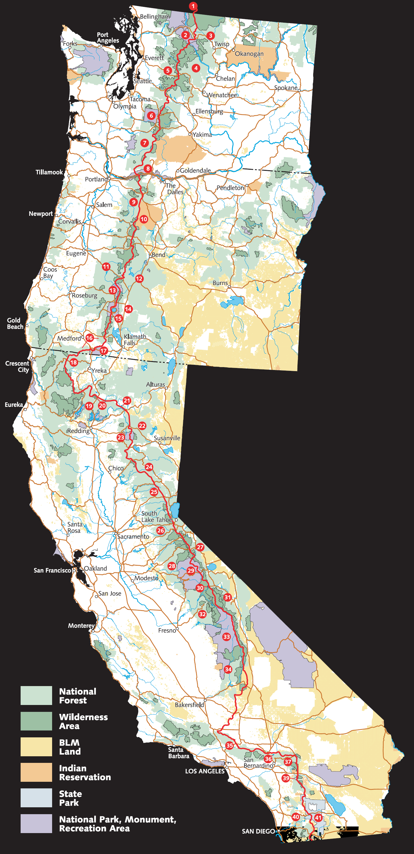
About the PCT:
From Wikipedia, the free encyclopedia:
The Pacific Crest Trail (commonly abbreviated as the PCT, and officially designated as the Pacific Crest National Scenic Trail) is a long-distance hiking and equestrian trail closely aligned with the highest portion of the Sierra Nevada and Cascade mountain ranges, which lie 100 to 150 miles (160 to 240 km) east of the U.S. Pacific coast. The trail's southern terminus is on the U.S. border with Mexico, just south of Campo, California, and its northern terminus on the Canada US border on the edge of Manning Park in British Columbia; its corridor through the U.S. is in the states of California, Oregon, and Washington.
The Pacific Crest Trail is 2,659 mi (4,279 km) long and ranges in elevation from just above sea level at the Oregon Washington border to 13,153 feet (4,009 m) at Forester Pass in the Sierra Nevada. The route passes through 25 national forests and 7 national parks. Its midpoint is near Chester, California (near Mt. Lassen), where the Sierra and Cascade mountain ranges meet.
It is the westernmost and second longest component of the Triple Crown of Hiking and is part of the 6,875 mile Great Western Loop.